
AI Landscape Visualization vs. a Professional Landscape Plan: Which Do You Need?
Compare an AI-generated landscape visualization with a scoped professional landscape plan, including inputs, deliverables, risks, and when to use both.
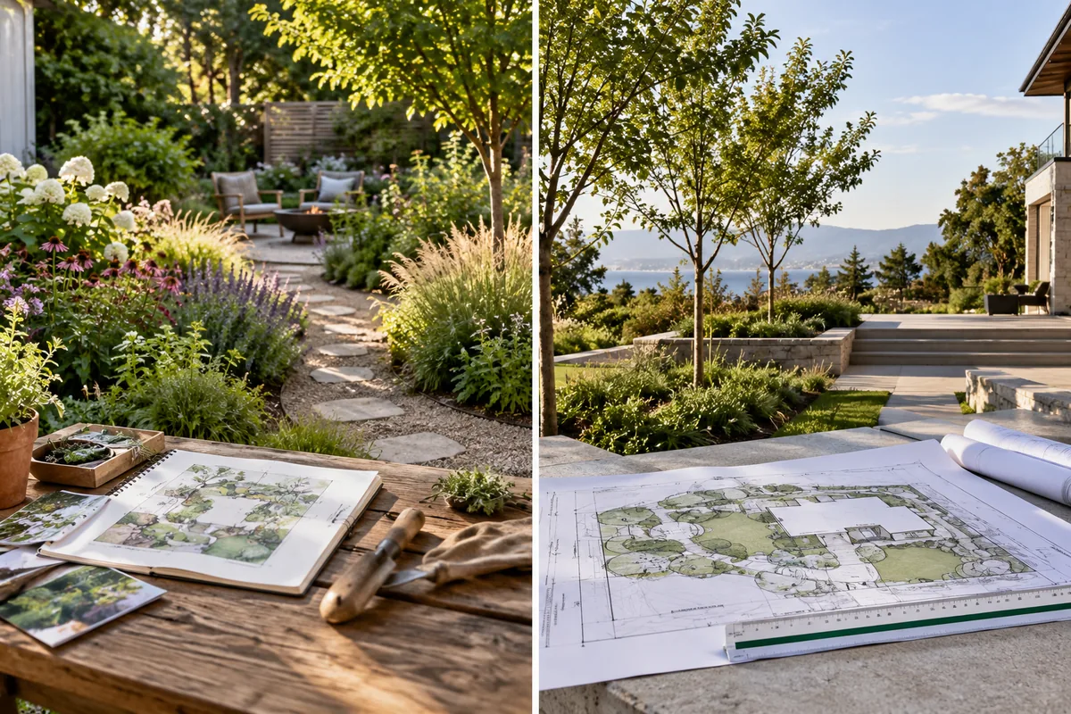
An AI landscape visualization and a professional landscape plan can both help move an outdoor project forward, but they answer different questions.
An AI visualization asks, “What visual direction could I explore?” A professional planning process asks, “What can be measured, specified, approved, priced, and built on this particular site?”
The first is useful for rapid ideation and communication. The second can turn an agreed direction into site-specific decisions and documents, depending on the professional’s qualifications and the scope in the contract. For many projects, the most efficient workflow is not choosing one instead of the other. It is using each at the right stage.
The short answer
Use an AI landscape visualization when you want to:
-
Compare broad styles or moods.
-
Explore an early layout direction from a property photo.
-
Clarify what you like and dislike before a consultation.
-
Create a visual brief for family members or professionals.
-
Test low-commitment ideas before paying for detailed planning.
Seek appropriately qualified professional help when you need to:
-
Measure or document the site accurately.
-
Change grading, drainage, retaining structures, decks, pools, stairs, walls, or elevated terraces.
-
Work around utilities, easements, setbacks, access, or permitting requirements.
-
Select plants for actual site conditions and long-term growth.
-
Specify materials, quantities, construction details, irrigation, or lighting.
-
Obtain coordinated pricing, approvals, or documents that others will rely on to build.
A realistic image can make an idea easier to discuss. It does not prove that the idea fits the property or that the visible plants and structures are suitable.
AI visualization and professional plan compared
QuestionAI landscape visualizationProfessional landscape plan or scoped design servicePrimary purposeExplore appearance, mood, and early directionResolve site-specific design decisions and agreed deliverablesTypical starting informationA photo, area type, style, and preferencesClient goals, site inventory, measurements or survey information, constraints, budget, and local requirementsTypical outputOne or more concept images or a visual briefDeliverables defined by contract, potentially including plans, details, schedules, specifications, or coordinationDimensional basisShould not be treated as measuredCan be developed from measured or surveyed informationPlant informationPlants may be illustrative or visually inferredA planting plan may identify selected plants, quantities, sizes, and locationsGrading and drainageCannot verify hidden conditions or engineer a solution from a photoMay be studied and documented by qualified professionals within the agreed scopeConstruction useNot contractor-readyMay support pricing, permitting, procurement, or construction when the required services are includedBest project stageEarly exploration and communicationDetailed design, approvals, procurement, and implementationRevision methodGenerate another visual directionControlled revisions to plans, details, selections, and specifications
The right-hand column is intentionally qualified. “Professional landscape plan” is not one universal package. A garden consultation, residential planting design, landscape-architect service, engineering package, and contractor proposal can contain very different information.
The Association of Professional Landscape Designers’ definition of landscape design says the scope may include site reconnaissance, inventory and analysis, client consultation, concepts, drawings, planting and material specifications, permit support, project management, and construction guidance. The phrase “may include” matters: the actual deliverables depend on the project and written agreement.
What an AI landscape visualization actually provides
A photo-based tool uses the visible scene and your instructions to generate a new image. With an AI landscape generator from a photo, you can upload an outdoor image, choose an area and style, describe elements to keep or add, and compare a generated concept with the starting photo.
That can help with decisions such as:
-
Modern versus cottage character.
-
Open lawn versus layered planting.
-
A stronger entry sequence in a front yard.
-
A dining, relaxation, or privacy direction in a backyard.
-
A visually cleaner route through a narrow side yard.
-
Furniture, planting, shade, and circulation ideas for a patio.
Depending on current account access, a user may also request another visual direction or try an available style. This is still image-to-image generation. It is not the same as moving a precisely measured object in CAD or revising a technical drawing.
A generated concept can be valuable even when it is not accurate enough to build. It can reveal preferences that are difficult to express in words: density, softness, symmetry, color, enclosure, formality, or how much hardscape feels comfortable.
For the photo-to-concept process itself, see how AI visualizes a garden idea from a photo.
What an AI image cannot establish
A single photo does not reveal everything that affects a landscape project. It cannot reliably establish:
-
Property boundaries, setbacks, easements, or public rights-of-way.
-
Exact lengths, levels, slopes, clear widths, and quantities.
-
Underground utilities, irrigation lines, or hidden drainage conditions.
-
Soil profile, compaction, contamination, or root conflicts.
-
Seasonal sun, wind, water movement, and microclimates.
-
Structural load capacity, waterproofing, anchorage, or retaining requirements.
-
Plant identity, hardiness, mature spread, toxicity, or local invasiveness.
-
Material availability, labor costs, permit requirements, or construction sequencing.
The image may also change a fixed feature, invent a plant, simplify a grade, or make an opening look wider than it is. A persuasive render is visual evidence of an idea, not evidence of site feasibility.
This does not make AI useless. It establishes the boundary: use the image to explore and communicate, then validate every decision that depends on real-world conditions.
What a professional landscape plan may include
A professional service begins by defining the client’s needs and the project scope. Depending on the job, location, qualifications, and contract, the work may include several of the following.
Existing-condition and site information
A designer may document the property’s orientation, access, architecture, circulation, existing vegetation, features to retain or remove, and environmental conditions. A measured base plan may come from field measurements, an owner-provided survey, or work by a surveyor.
Professional portfolios assessed through APLD certification are expected to show site inventory or existing conditions, the client program, design response, and documented plans. That is a much richer evidence base than one perspective photo.
Concept and layout plans
A concept plan can organize circulation, activity areas, planting masses, structures, views, and relationships between spaces. It may still be an early design document, but it is tied to a site and client program rather than generated only for visual effect.
Hardscape plans and details
When included, hardscape documentation may show patios, decks, paths, pools, fences, retaining systems, structures, major dimensions, materials, or construction details. Some elements require additional engineering, manufacturer input, specialist design, or permit review.
Planting plans
An actual planting plan can identify existing and proposed plants, botanical names, locations, quantities, installation sizes, and planting details. APLD’s certification requirements, for example, call for a planting plan and plant list with botanical and common names, quantities, sizes, and remarks.
That does not mean every professional automatically guarantees plant success. Site preparation, sourcing, installation, weather, care, pests, and changing climate conditions still matter. It does mean the selections can be made against more specific site information than an AI render provides.
Grading, drainage, and technical coordination
Changing landform or water movement can affect buildings and neighboring properties. The Council of Landscape Architectural Registration Boards treats grading, drainage, stormwater, construction documentation, materials, and construction methods as competencies connected to public health, safety, and welfare. Its Uniform Licensure Standard identifies site-preparation plans, general plans and details, specialty plans, and specifications within the grading, drainage, and construction-documentation experience domain.
The required professional varies by jurisdiction and task. A landscape architect may address some of this work; a civil or structural engineer, surveyor, arborist, irrigation designer, or other specialist may also be necessary.
Construction and implementation support
Professional involvement can continue after drawings are complete. The American Society of Landscape Architects’ construction administration guidance describes the practitioner’s role in helping carry the specified design and materials into built work, potentially continuing through construction, upkeep, and the warranty period.
Construction administration is not automatically included in every design fee. Ask what site visits, submittal review, contractor questions, substitutions, punch-list work, and closeout support are included.
When an AI concept may be enough for the current decision
An AI visualization may be enough when the decision is genuinely visual and reversible.
Examples include:
-
Choosing between two garden styles before requesting proposals.
-
Deciding whether you prefer a more open or enclosed feeling.
-
Testing broad planting density around an existing path.
-
Exploring furniture and container-planting character on a ground-level patio without committing to construction.
-
Creating a moodboard for a consultation.
-
Showing a household member what “more layered planting” might mean.
“Enough” here means enough for the current conversation, not enough for installation. If the next step is only refining preferences, a detailed professional package may be premature.
You can make the concept more useful by marking it up with three categories:
-
Keep: existing elements that must remain.
-
Explore: visual changes you want to discuss.
-
Verify: anything involving dimensions, plant suitability, drainage, structure, rules, or cost.
That turns an attractive image into a clearer brief without pretending it is a plan.
When to involve a professional before going further
The cost of being wrong is the clearest decision rule. Professional input becomes more important when an error could damage property, create a safety issue, waste substantial materials, block access, or require expensive rework.
Front yard
A visualization can compare entry, walkway, planting, and curb-appeal directions. Seek site-specific help before relying on it for property lines, setbacks, utilities, public sidewalks, driveway sightlines, accessible routes, or mature planting near traffic and structures.
Backyard
A concept can help discuss activity zones, privacy, dining, lawn, and planting character. Bring in qualified help for grading, drainage, utilities, retaining work, pools, decks, permits, structural elements, irrigation, and planting quantities.
Side yard
An image can make a narrow circulation idea easier to understand. It cannot confirm required clear width, emergency egress, gate swing, utility access, equipment clearance, roof-water handling, or a workable drainage route.
Patio or terrace
A visual can compare seating, planting, shade, and outdoor-kitchen ideas. It cannot establish structural capacity, waterproofing, wind resistance, attachment methods, guard and stair safety, or exit compliance. Elevated spaces and heavy planters deserve particular caution.
Who might you need?
Job titles and regulated responsibilities differ by location, so focus on the task and required qualification.
-
Landscape designer: May provide site analysis, concepts, planting design, material selection, and project guidance. Services and credentials vary.
-
Landscape architect: A regulated professional in many jurisdictions, often relevant when public health, safety, grading, drainage, complex documentation, or permitting is involved.
-
Surveyor: Establishes boundaries, topography, and other measured property information within the survey scope.
-
Civil or structural engineer: May be required for drainage, grading, retaining structures, foundations, loads, or other engineered systems.
-
Arborist: Assesses existing trees, health, risk, root zones, and protection requirements.
-
Landscape contractor: Prices and installs work; some firms also offer design, but confirm who is responsible for documentation and technical decisions.
-
Local nursery or horticultural specialist: Helps verify plant availability and suitability for local conditions.
Do not assume one company covers every role. Ask who prepares each document, who checks it, and who carries responsibility for regulated or safety-critical work.
A practical AI-to-professional workflow
AI and professional planning work well together when the handoff is explicit.
Step 1: Photograph the space for orientation
Use a clear photo that shows the house or another fixed reference, the main ground plane, boundaries visible from the camera, and major elements that must remain. Do not expect the image to replace measurements or a survey.
Step 2: Generate several distinct directions
Explore genuinely different approaches instead of repeatedly asking for tiny variations. For example, compare a restrained modern concept, a softer cottage direction, and a lower-water Mediterranean or xeric character where appropriate.
The practical guide to AI garden visualization explains how to prepare an input and evaluate the result without mistaking it for a finished plan.
Step 3: Separate preference from fact
For each concept, write down:
-
What you like visually.
-
What must stay unchanged.
-
What the image may have invented or distorted.
-
What needs measurement or local verification.
-
What you do not yet know about budget, maintenance, or timing.
Step 4: Create a one-page visual brief
A useful brief can include:
-
One to three preferred images.
-
A short project goal.
-
Required activities and access.
-
Elements to keep, remove, or investigate.
-
Style and maintenance preferences.
-
Known constraints.
-
A realistic budget range if you have one.
-
Questions for the professional.
You can use before-and-after landscape examples to discuss visual character, but do not present an AI showcase as evidence that the same result was built or will work on your site.
Step 5: Ask for a written scope
Before commissioning professional work, ask what the service includes:
-
Site visit and measurements.
-
Survey requirements.
-
Concept options and revision rounds.
-
Planting plan and plant schedule.
-
Hardscape plans, grading, drainage, irrigation, or lighting.
-
Details and specifications.
-
Permit or HOA support.
-
Cost planning or contractor coordination.
-
Construction administration.
-
Deliverable format and ownership.
Also ask what is specifically excluded and which other specialists may be required.
Step 6: Let verified information change the concept
A professional process may reveal that the preferred image conflicts with drainage, roots, setbacks, budget, maintenance, or available materials. That is not a failure of the visualization. It is the point where site evidence improves the idea.
The final direction may keep the image’s atmosphere while changing dimensions, species, grades, materials, or construction details.
Questions to ask before relying on any deliverable
Whether you are reviewing an AI image or a professional proposal, ask:
-
What decisions is this deliverable intended to support?
-
What site information was actually measured or verified?
-
Which visible elements are illustrative?
-
Are plant names, quantities, and sizes specified?
-
Are grading, drainage, utilities, structures, and permits included or excluded?
-
Can contractors price the same scope from these documents?
-
Who is responsible for technical and regulatory decisions?
-
What revisions and implementation support are included?
Clear answers prevent a concept image, planting sketch, contractor estimate, and construction document from being treated as if they were the same thing.
Final takeaway
AI landscape visualization is strongest at the beginning of a project. It can make preferences visible, widen the range of ideas, and improve the first conversation.
A professional landscape plan or scoped design service is strongest when the project must respond to the real site and produce information that other people can rely on. The exact service may range from planting design to a coordinated package involving surveys, technical plans, specifications, permitting, engineering, and construction support.
Use AI to answer, “Which direction should we explore?” Use appropriately qualified professionals to answer, “What will work here, what must be documented, and how should it be implemented?” Keeping those questions separate lets both tools do their best work.